| |
| GIS |
| GPS |
| TRAINING |
| CONSULTING |
| CONTACT |
| NEWS |
2012 Texas GIS Forum Waypoint Mapping's Devon Humphrey presented "Realtime Aerial Visual Intelligence for GIS " at the Texas GIS Forum in Austin. Examples of how Unmanned Aerial Vehicles and traditional piloted aircraft are being used to provide current high definition visual content for GIS were demonstrated. Applications includeemergency management, pipeline and electrical right-of-way monitoring, environmental studies, agriculture, archeology and many others. This is the next big wave of geospatial content, moving imagery from being just a basemap to an operational layer.
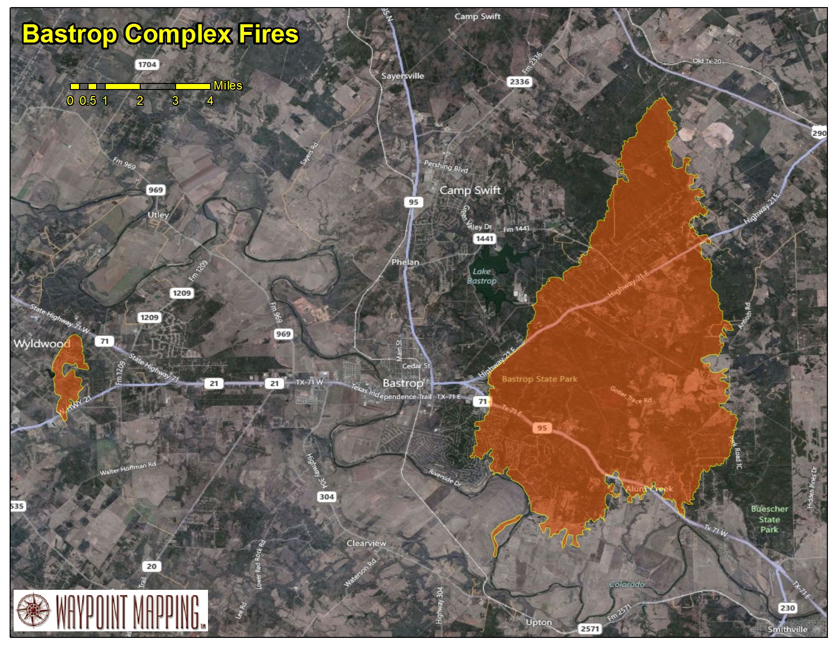
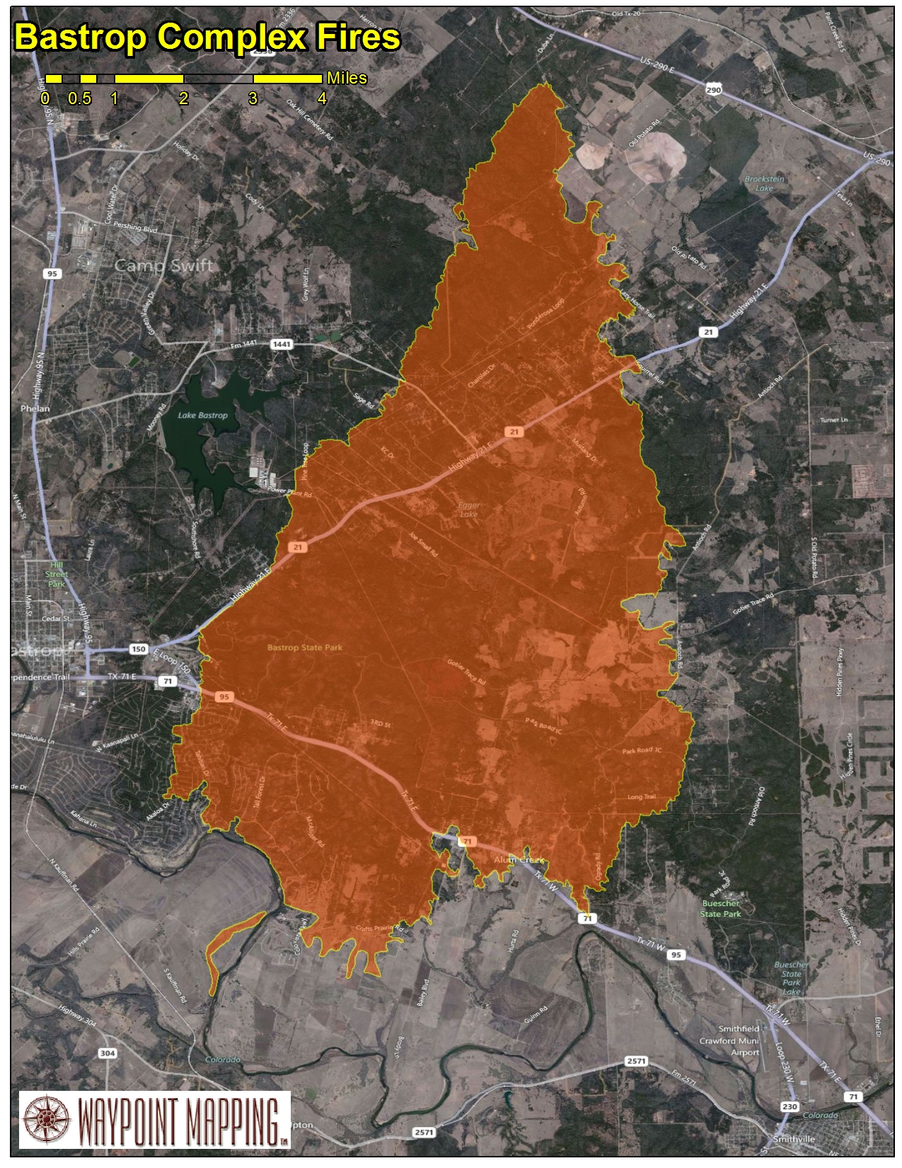
2011 Texas GIS Forum Waypoint Mapping's Devon Humphrey recently presented "GIS as a Common Operational Picture for Emergency Management" at the Texas GIS Forum in Austin. Attendees were treated to real-world examples from Hurricane Ike, the Deepwater Horizon Oil Disaster in the Gulf and the recent Central Texas Wildfires. The use of ESRI's ArcGIS Server, ArcGIS Mobile, iOS apps and new HTML 5 were showcased as standard tools of the trade. Texas Wildfires 2011 Over 3.75 million acres burned during the 2011 Texas Wildfire season. Over 1700 homes burned in the Central Texas Labor Day Wildfires alone. GIS Web Services and Mobile technologies provide a Common Operational Picture, whether viewed on laptops or smart phone devices. Simple PDF status maps can be posted to a web site or emailed to the field. (CLICK ON ANY THUMBNAIL TO SEE FULL-SIZE IMAGE.)
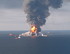
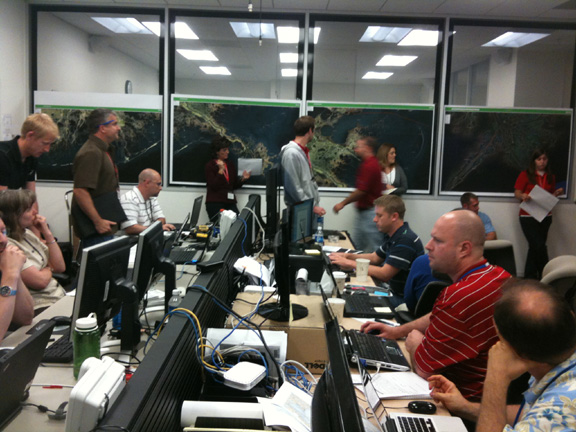
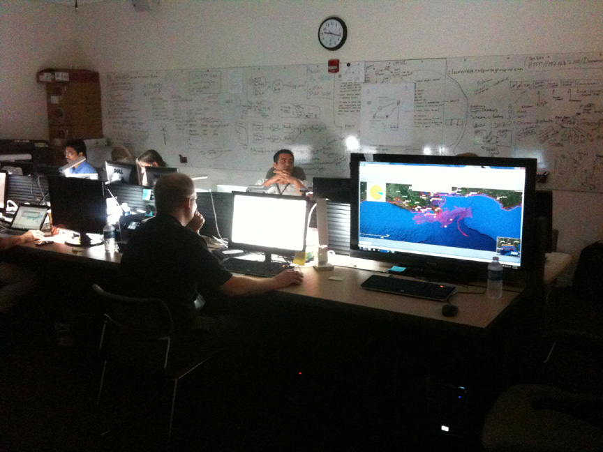
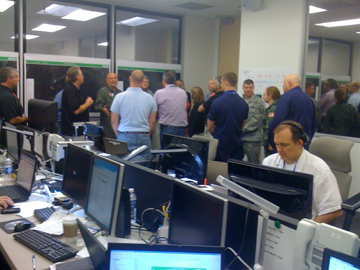
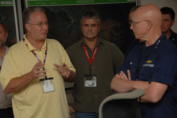
2011 ESRI Petroleum User Group Conference in Houston, Texas Devon Humphrey recently presented "Booms & Plumes - GIS Smoke Jumpers at the Deepwater Horizon Gulf Oil Disaster" at the ESRI Petroleum User Group Conference in Houston. The session was attended by petroleum industry GIS professionals from around the world. 2010 ESRI Canada User Conference in Ottawa, Ontario Devon Humphrey delivered the keynote address on the topic of "GIS Smoke Jumpers" at the Deepwater Horizon Oil Disaster in the Gulf on October 19, 2010. This Canadian national GIS conference included attendes from a variety of government and private sector organizations. The presentation included examples of how ESRI's ArcGIS 10 Desktop, Server and Mobile were all put to work battling the Gulf Oil Disaster. 2010 Deepwater Horizon Oil Disaster in the Gulf Waypoint Mapping and a team of "GIS Smoke Jumpers" traveled to Louisiana in May to establish an Enterprise GIS at the Incident Command Post for the Deepwater Horizon oil disaster in the Gulf. The GIS was used to track and manage a wide variety of map information from literally dozens of organizations, for both operational and archival purposes. A Common Operational Picture was provided through several simultaneous feeds: ArcGIS Server for ArcMap users, Google Earth KML and also through a simple, yet powerful Flex web-based map viewer, complete with analysis tools. See the related article from the Summer 2010 edition of ESRI's ArcNews on GIS at the Deepwater Horizon Oil Spill. See the related article from the July 2010 edition of Point-of-Beginning (POB) GIS Smoke Jumpers |
Deepwater Horizon Explosion

Deepwater Horizon in GIS
Deepwater Horizon GIS Lab
Deepwater Horizon GIS Lab

Deepwater Horizon GPS Aerials
Admiral Thad Allen in GIS Lab
Admiral Bob Papp in GIS Lab
GIS Smoke Jumpers
GIS Smoke Jumpers